


Cu-Zn-Ag VMS project across 121 km² (14 granted claims) and roughly 29 km of prospective strike on the Hersjø Volcanic Belt, central Norway.
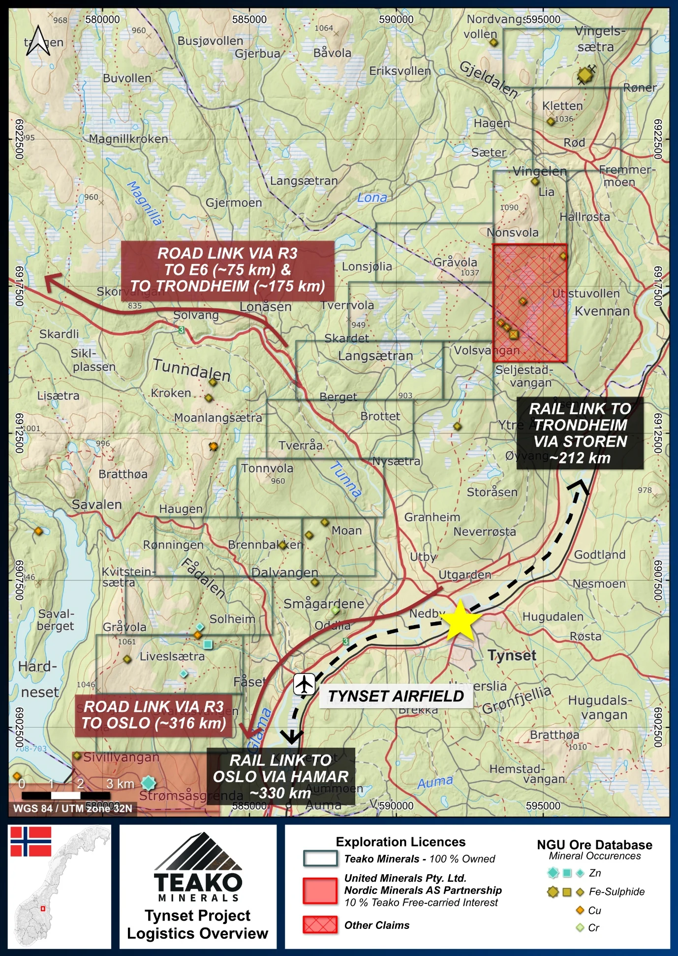
Tynset project, advancing toward drilling: 14 granted claims across 121 km² of the Hersjø Volcanic Belt in central Norway, holding roughly 29 km of prospective strike for copper-zinc-silver VMS discovery. A railway line on the project’s eastern boundary connects to the deep-sea ports of the Trondheim area.
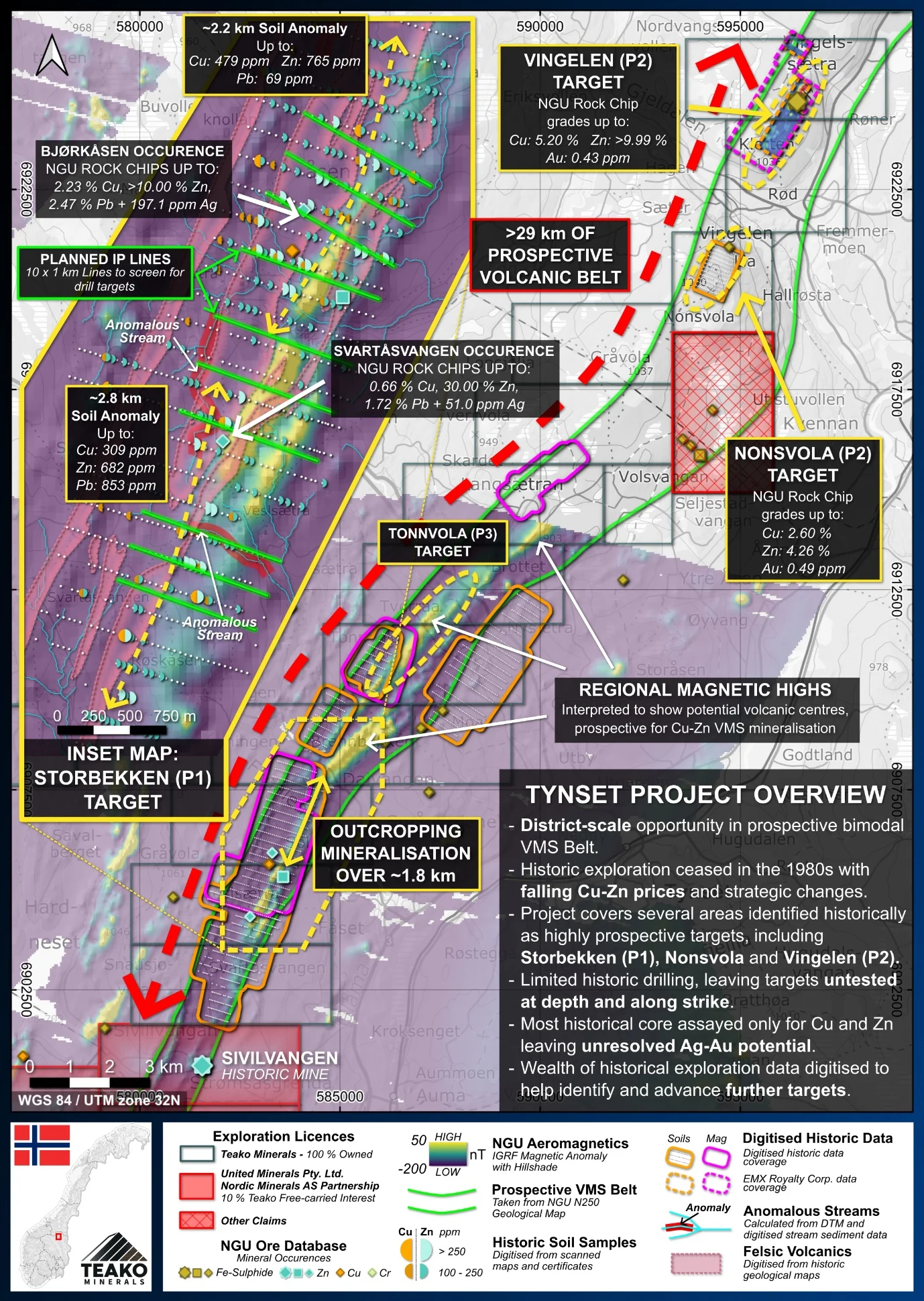
- Priority 1 target defined: Storbekken, with significant copper-zinc soil anomalism over ~5 km of strike, coincident with hydrothermally altered and mineralized felsic volcanics
- Digitized historical database: over 1,400 soil samples, 335 stream-sediment samples and more than 1,800 ground magnetometer readings1,2
- Historical rock chips up to 2.44% Cu, 30.93% Zn and 14.94% Pb, with NGU samples grading up to 197.1 g/t Ag1,2
- Established infrastructure: rail on the eastern boundary, Norwegian National Road 3 through the project area
The Tynset Project sits within the Tynset municipality, Innlandet County. The belt is considered fertile for the discovery of Cu-Zn-Ag VMS systems (Grenne, Vokes and Ihlen, 1999). Tynset is also contiguous to the Sivilvangen project, in which Teako holds a 10% free-carried interest up to final investment decision through its partnership with Nordic Minerals AS, a wholly owned subsidiary of United Minerals Australia Pty Ltd (see press release dated January 5, 2026).
{{fig:1}}
The belt was explored by Norwegian mining company Folldal Verk A/S through the 1980s, and work stopped in the late 1980s on declining commodity prices and changing priorities, not exhausted geology. That historical database now underpins Teako’s targeting.
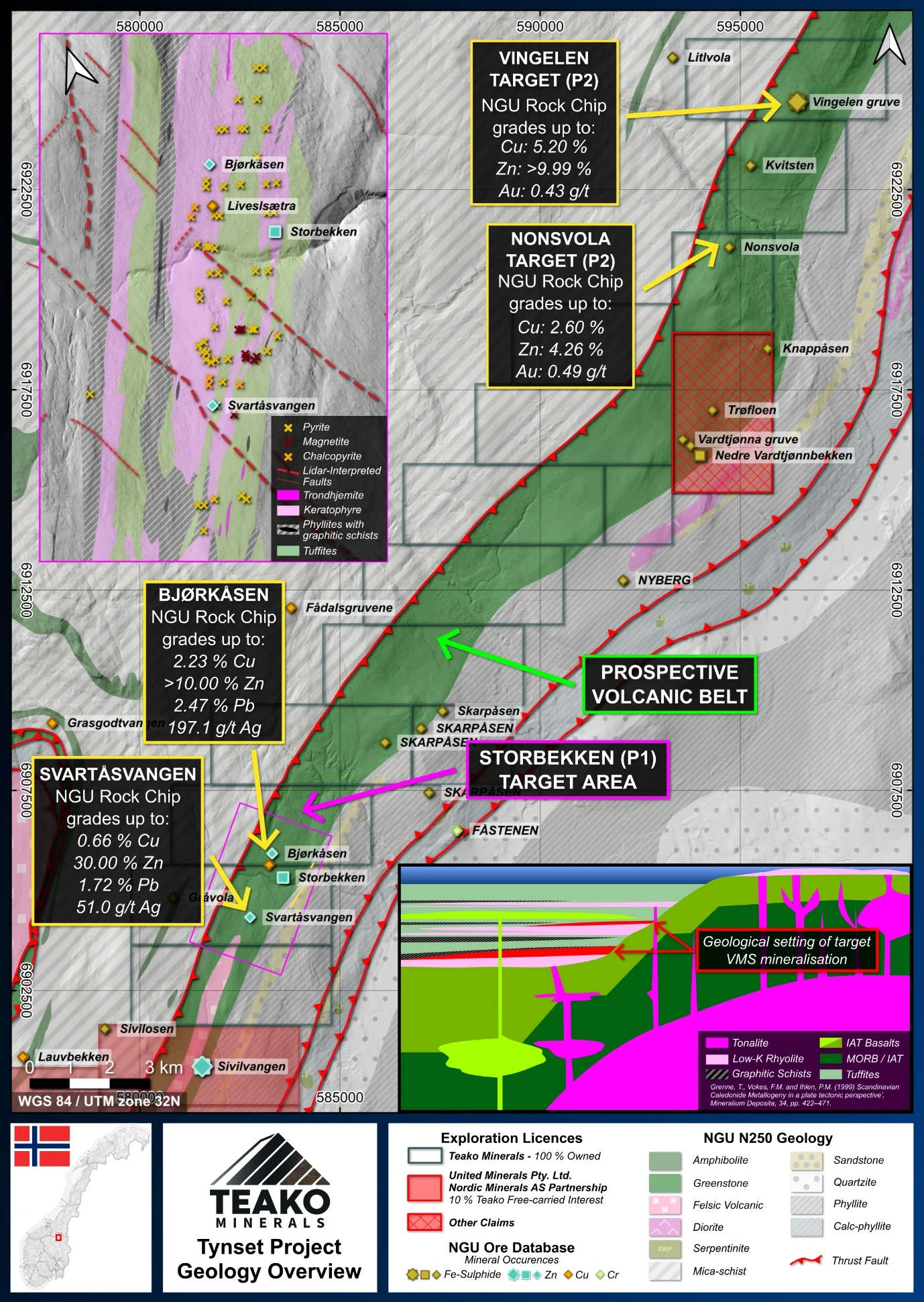
The Tynset belt is a bimodal volcanic sequence of mafic and felsic volcanic rocks with intercalated metasedimentary rocks, including graphitic phyllites, and local sulfide occurrences. Recently published airborne geophysics from the Norwegian Geological Survey (NGU) sharpens the picture across the full belt.
{{fig:2}}
Copper-zinc soil anomalism over ~5 km of strike, coincident with altered and mineralized felsic volcanics. Limited historical drilling (5 holes, 585 m) intersected intense hydrothermal alteration, interpreted by Teako as proximity to a VMS hydrothermal system. Only 30.25 m of that core was ever assayed, solely for Cu and Zn; the best visual interval, estimated at 10-15% sphalerite from 45.60 to 47.40 m in hole S-83-4, was never assayed (Bjerkgård, 1990).
Clear similarities to Storbekken at the north-east end of the project: base metal mineralization in outcrop, with NGU rock chips up to 2.60% Cu, 4.26% Zn and 0.49 g/t Au, and in historic drill core through altered felsic volcanics. Soil anomalies up to 1,700 ppm Zn support targeting (Bakke and Wilberg, 1984).
The historic Vingelen Mine sits ~4.5 km along strike from Nonsvola. NGU report an estimated 30 Kt of sulphide ore produced at 1.30% Cu, with historical drilling indicating mineralization down to a depth below surface of ~210 m (NGU, 2024)3. The deposit is interpreted as a fold repetition of one sulphide horizon; the untested hinge zone is the target for a thickened, potentially economic body (Bjerkgård, 1989).
Multiple untested areas where strong aeromagnetic anomalies are interpreted as potential volcanic centres that may host VMS mineralization.
{{fig:3}}
Structural mapping, outcrop sampling and an Induced Polarization (IP) geophysical survey
Follow-up diamond drilling on priority targets
1,2 Teako has not performed sufficient work to verify the published data reported above, but the Company believes this information to be considered reliable and relevant. Results reported are maximum values and may not be representative of all samples collected within the area being evaluated.
3 References made to nearby mines and analogous deposits provide context for the regional targets but are not necessarily indicative that these targets host similar tonnages or grades of copper mineralization.
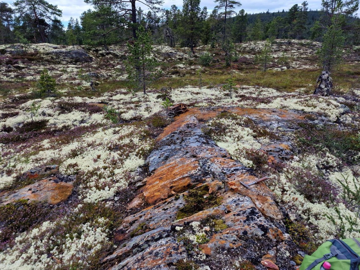
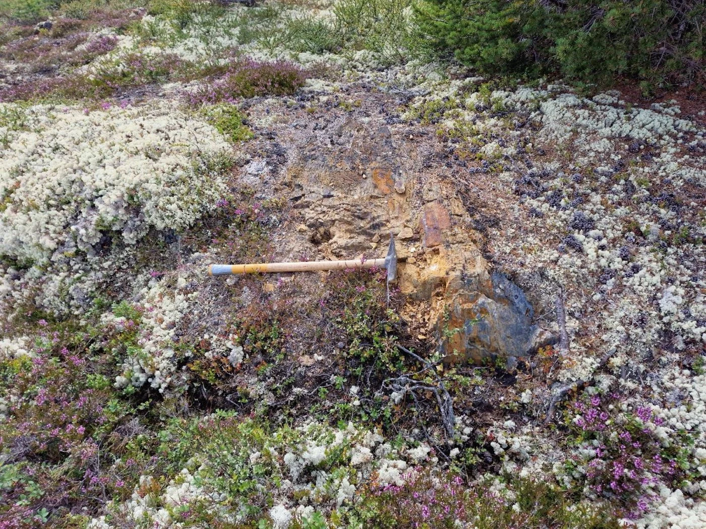
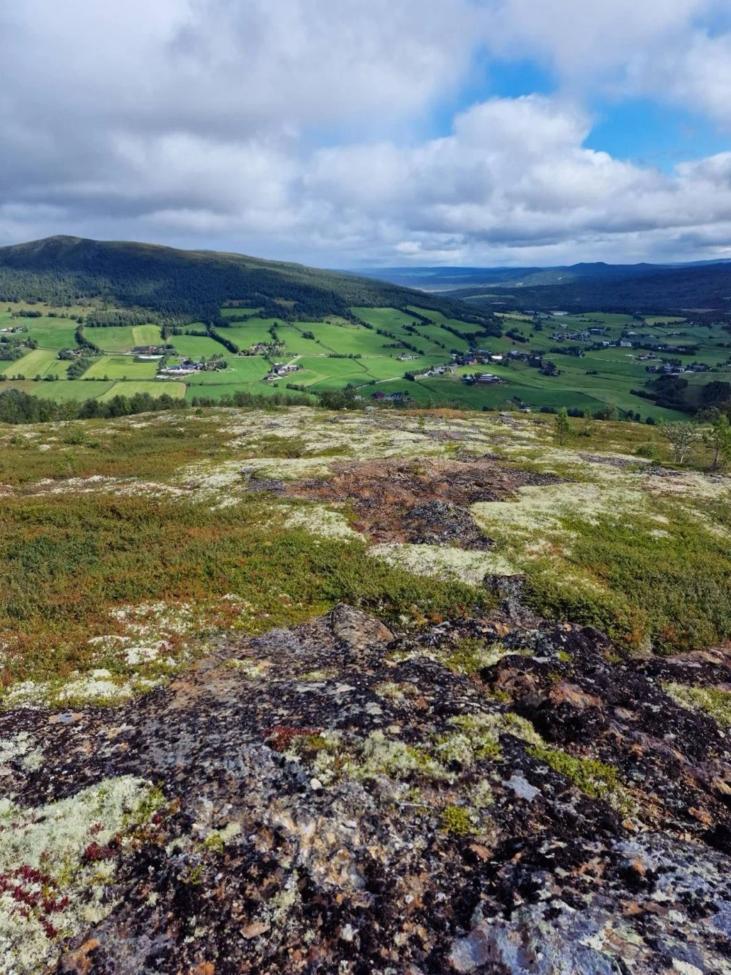
Field imagery
{{fig:4}}
{{fig:5}}
References
Bjerkgård, T. (1990) BV5641 – The Nord-Østerdalen Project 1990. Folldal Verk A/S, p. 27.
Cuttle, J. (1982) BV3093 – Folldal Project 1982 Maps. Map Appendices N-81-1. Folldal Verk A/S, Amoco Norway Oil Company.
Folldal Verk A/S (1981) BV3091 – Folldal Project 1981 Maps. Map Appendices N-81-1. Folldal Verk A/S, Amoco Norway Oil Company.
Folldal Verk A/S (1982) ‘BV4176 – Geokjemi 1982, Folldal prosjekt.’ Folldal Verk A/S.
Krog, R. (1968) BV2925 – Geokjemiske undersokelser: Grimsdalen III, Savalen IV. NGU Report 760. Trondheim: NGU, Folldal Verk AS.
Bakke, O. and Wilberg, R. (1984) FOLLDAL PROJECT (N-81-1): 1983 Summary. Annual Report BV3096. Folldal Verk A/S, Amoco Norway Oil Company, p. 66.
Bjerkgård, T. (1989) Regionalgeologiske Undersøkelser i Vingelenfeltet, Nord-Østerdalen, i det sørlige Trondheimsfeltet, med henblikk på sulfidmineraliseringene. Cand. scient. oppgave. Universitetet i Oslo.
Grenne, T., Vokes, F.M. and Ihlen, P.M. (1999) ‘Scandinavian Caledonide Metallogeny in a plate tectonic perspective’, Mineralium Deposita, 34, pp. 422–471.
References to the NGU Resource Database are consolidated under this citation for simplicity. For all data sourced from this resource, please refer to: https://geo.ngu.no/kart/mineralressurser_mobil/?lang=eng
Exploration-stage project. Any historical production, grades or estimates quoted in project descriptions are historical in nature, have not been verified by the Company as current mineral resources or reserves, and should not be relied upon. See the cautionary statements and the Qualified Person statement.