


60 km² of Fundsjø Formation greenstones 15 km from Tynset, hosting the Sivilvangen VMS deposit (historical estimate ~267 kt at 0.72% Cu and 5.27% Zn).
Sivilvangen Project
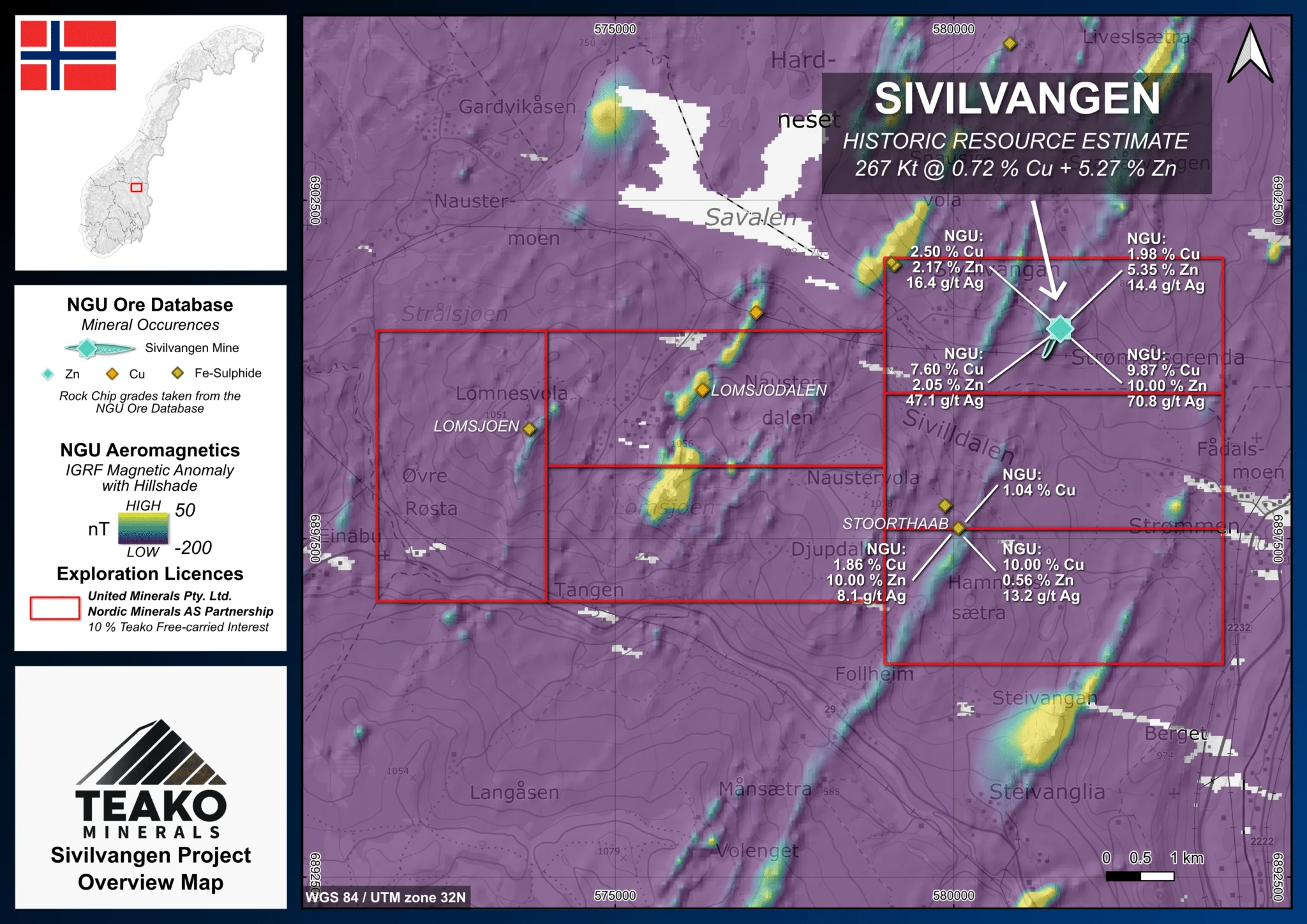
The Sivilvangen Project (see Figure 1) comprises six claims covering a total area of 60 km² in eastern Trøndelag. The Project is located approximately 15 km from the town of Tynset and benefits from well-developed infrastructure. The railway line to the deep-sea ports in the Trondheim area runs along the southeastern Project boundary. In addition, Sivilvangen covers prospective greenstones of the Fundsjø Formation, which extend southwest toward the Folldal Mining District, historically a major driver of industry in the region.
The Project hosts the Sivilvangen VMS deposit (historical mineral estimate of ~267 kt @ 0.72% Cu and 5.27% Zn) (Killi, Juhava and Bjerkgård, 1991)2. Like many deposits within the Caledonides, it displays a ruler-shaped morphology, with clearly zoned mineralization characterized by copper enrichment relative to zinc closer to surface.
Aeromagnetic data delineate the Fundsjø Formation both within and beyond the Project area, defining tens of kilometres of prospective strike length. The unit is approximately 1-2 km wide, forming a relatively compact belt suitable for systematic exploration. These factors, combined with the district’s rich mining heritage, make the Sivilvangen Project highly favourable for further exploration and potential expansion.
{{fig:1}}
1Teako has not performed sufficient work to verify the published data reported above, but the Company believes this information to be considered reliable and relevant. Results reported are maximum values and may not be representative of all samples collected within the area being evaluated
2References made to nearby mines and analogous deposits provide context for the regional targets but are not necessarily indicative that these targets host similar tonnages or grades of mineralization.
Exploration-stage project. Any historical production, grades or estimates quoted in project descriptions are historical in nature, have not been verified by the Company as current mineral resources or reserves, and should not be relied upon. See the cautionary statements and the Qualified Person statement.