


VMS-style Cu project of roughly 25.0 km² in Northern Norway.
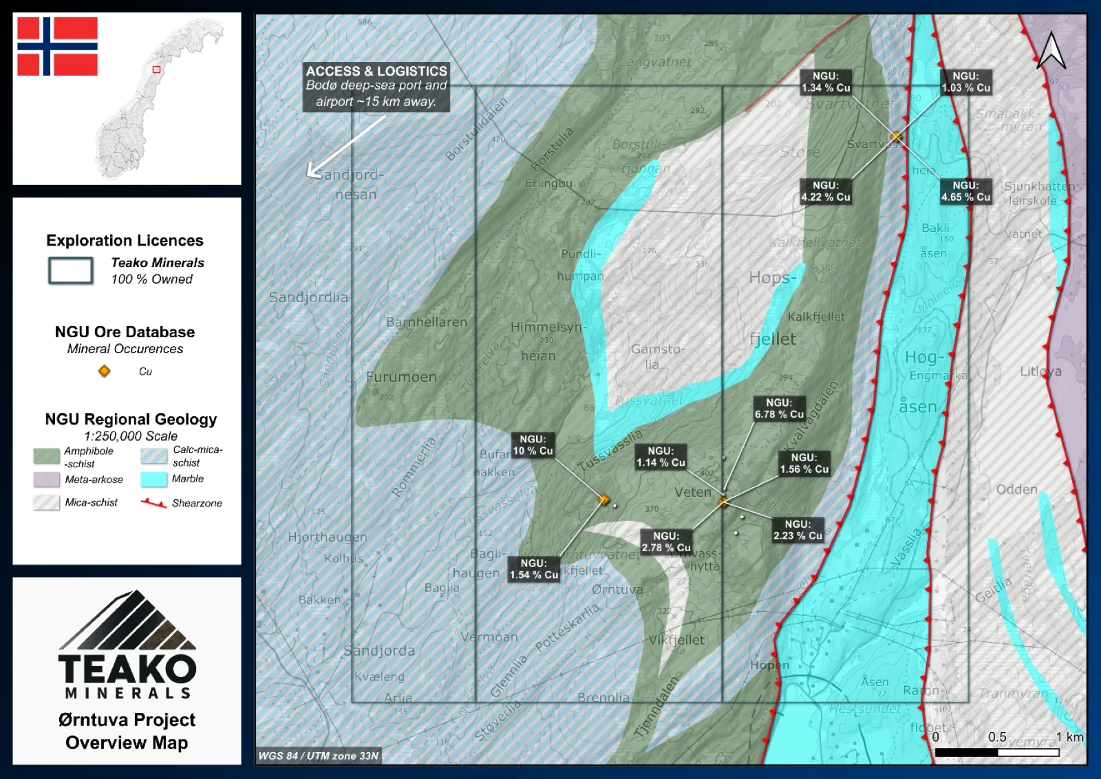
Teako’s 100% owned Ørntuva Project covers 25 km2 and is located around 15 km northeast of Bodø, northern Norway. The project benefits from excellent access via Road 80 and forest tracks. The licences cover the historic Bodin ore field, including the Hopen, Tussvatnet, and Brattfjell mines, which operated intermittently between 1897 and 1916. The Hopen and Tussvatnet occurrences are hosted in foliated amphibolite schist, while Brattfjell mineralization occurs along the contact between garnet mica schist and amphibolite. Hopen features massive chalcopyrite-pyrrhotite ores up to 2 m thick, with historical copper grades averaging 12 % and local highs of 20–25 %, and minor nickel (Mason, 1967)1. Tussvatnet hosts five parallel massive sulphide zones of pyrrhotite and chalcopyrite, totalling 1–4 m thick, while Brattfjell comprises steeply dipping pyrrhotite-chalcopyrite bodies interpreted within a fold hinge. Whilst excellent Cu grades are known from the property, further exploration is required to assess further potential of this area.
{{fig:1}}
1Teako has not performed sufficient work to verify the published data reported above, but the Company believes this information to be considered reliable and relevant. Results reported are maximum values and may not be representative of all samples collected within the area being evaluated
2References made to nearby mines and analogous deposits provide context for the regional targets but are not necessarily indicative that these targets host similar tonnages or grades of mineralization.
References
BV2286: Mason (1967). Geological report on the Hopen-copper-mine area. Hopen Kopper.
References to the ‘NGU’ regard the ‘Norwegian Geological Survey’, in particular, their Resource Database and are consolidated under this citation for simplicity. For all data sourced from this resource, please refer to: https://geo.ngu.no/kart/mineralressurser_mobil/?lang=eng
Exploration-stage project. Any historical production, grades or estimates quoted in project descriptions are historical in nature, have not been verified by the Company as current mineral resources or reserves, and should not be relied upon. See the cautionary statements and the Qualified Person statement.