


Skarn-style W project of roughly 8.8 km² in Northern Norway.
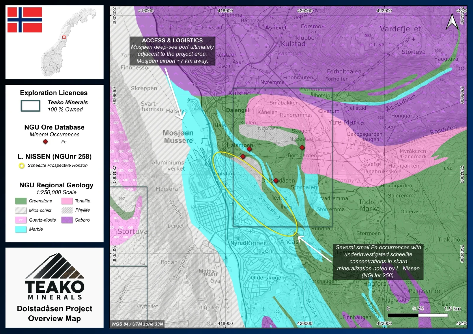
The 100% owned Dolstadåsen project comprises a single claim block covering 9 km2 with select target areas identified, following historical studies in the Mosjøen region. The project area encompasses zones that were originally highlighted during the geological mapping of a region in Helgeland, which took place from the 1940s through the 1960s.
A key focus of the project is based on historical mapping efforts targeting scheelite. During this period, an occurrence of scheelite was discovered in a marble quarry located 1 km north of the railway station in Mosjøen (Nissen, 1969)1,2. Geologically, the scheelite in this area typically presents as clusters in bands or lenses, frequently as impregnations in quartz segregations within these bands, or as thin veinlets within skarn veins.
The primary opportunity at Dolstadåsen lies in its lack of recent exploration. Currently, no modern assay data exists for these historical occurrences. It is highly probable that these specific mineralizations have been overlooked in recent decades. Because of this gap in modern testing, the Dolstadåsen area presents compelling, historically backed targets that strongly warrant further investigation.
{{fig:1}}
1Teako has not performed sufficient work to verify the published data reported above, but the Company believes this information to be considered reliable and relevant. Results reported are maximum values and may not be representative of all samples collected within the area being evaluated
2References made to nearby mines and analogous deposits provide context for the regional targets but are not necessarily indicative that these targets host similar tonnages or grades of mineralization.
References
Nissen, A. L. (1969) ‘A new Norwegian occurrence of scheelite’, NGU rapport nr. 258.
References to the ‘NGU’ regard the ‘Norwegian Geological Survey’, in particular, their Resource Database and are consolidated under this citation for simplicity. For all data sourced from this resource, please refer to: https://geo.ngu.no/kart/mineralressurser_mobil/?lang=eng
Exploration-stage project. Any historical production, grades or estimates quoted in project descriptions are historical in nature, have not been verified by the Company as current mineral resources or reserves, and should not be relied upon. See the cautionary statements and the Qualified Person statement.