


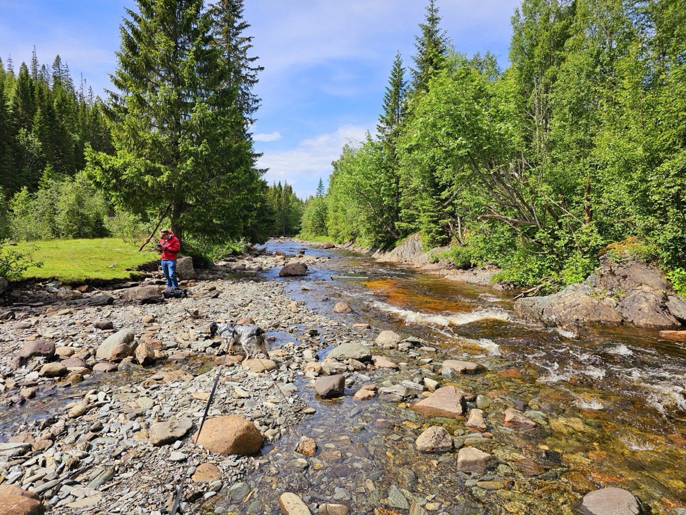
Cu-Zn VMS project covering ~285 km² in Trøndelag, focused on the Mostadmarka Formation and its three high-priority sub-targets.
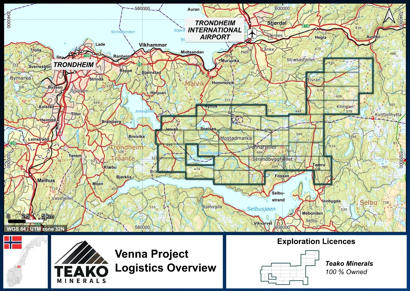
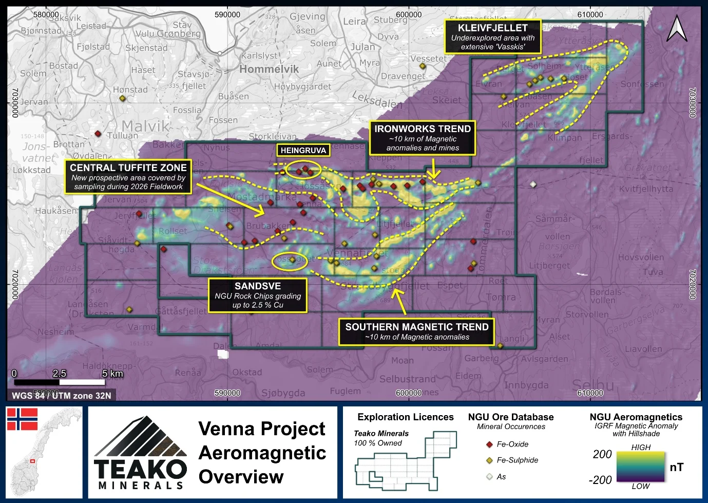
A 285 km² greenfields district in Trøndelag, on the Mostadmarka Formation: a mafic volcanic rift basin with clear similarities to the Løkken district and the Tverfjellet and Joma deposits. Very little VMS exploration is on record here, which makes Venna one of the least-explored search spaces in the Norwegian mineral belts.
- Over 200 historic near-surface ironworks along the Mostadmarka trend mark the prospective horizon
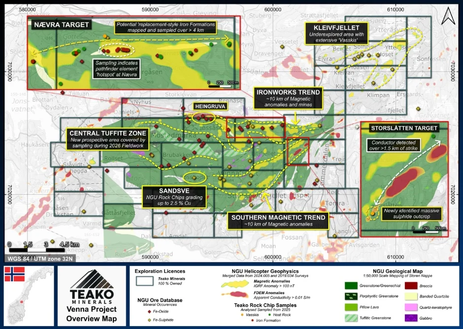
- Storslåtten: a 2.2 km electromagnetic conductor associated with outcropping pyrite and a hydrothermal geochemical signature
- Two further geochemical targets on the northern trend: Nævra and Heingruva
- A research project on iron-formation fertility begins from the 2025 sampling campaign
Venna sits in Trøndelag County, central Norway, within greenstone belts renowned for historic copper production from volcanogenic massive sulphide (VMS) deposits. The project is focussed on the Mostadmarka Formation and its historical ironworks trend: over 200 near-surface workings on hematite- and magnetite-rich iron formations.
{{fig:1}}
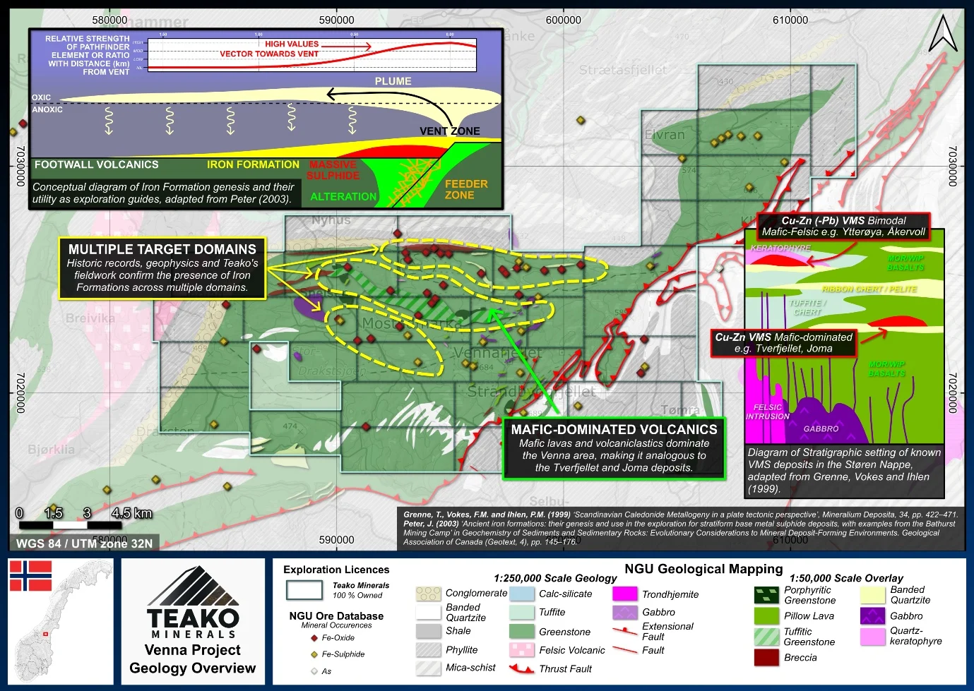
Iron formations form through the action of hydrothermal fluids at or below the sea floor, which makes them marker horizons for VMS-style mineralization: in a typical VMS model they can sit on the same horizon as massive Cu-Zn sulphides, and their geochemistry can vector toward the vent source. The same relationship is observed at the Tverfjellet mine south of Venna, in the Løkken district, and in the Bathurst Mining Camp in Canada, where iron-formation exploration played a critical role in the discovery of the Bathurst 12 and 6 deposits. Teako interprets Venna’s iron formations as potential markers for a concealed Cu-Zn-rich VMS system beneath.
{{fig:2}}
A 2.2 km electromagnetic conductor on the southern magnetic trend, associated with outcropping pyrite mineralization and a geochemical signature indicating a hydrothermal origin. Graphitic schist is limited in the area, so the conductor is currently interpreted as more likely sulphide-related, with a potential stratigraphic connection to the Sandsve area.
On the northern ironworks trend (~10 km of strike): geochemistry indicating hydrothermal replacement, which the literature typically links to higher metal grades.
Samples indicate a pure hydrothermal vent origin, in the form of magnetite-bearing jaspers.
{{fig:3}}
More than 150 rock chip samples have been collected in traverses over the critical target trends, screening a wide area for prospective hydrothermal alteration haloes through geochemical and spectral analysis. Results will focus future exploration on the most promising parts of the district.
{{fig:4}}
Capital-efficient mapping and sampling programs across iron formations and host volcanics
Advanced geophysical surveys over identified hot-spots to drive drill targeting
Exploration-stage project. Any historical production, grades or estimates quoted in project descriptions are historical in nature, have not been verified by the Company as current mineral resources or reserves, and should not be relied upon. See the cautionary statements and the Qualified Person statement.