


Pegmatite-style U-Th-REE project of roughly 30.0 km² in Southern Norway.
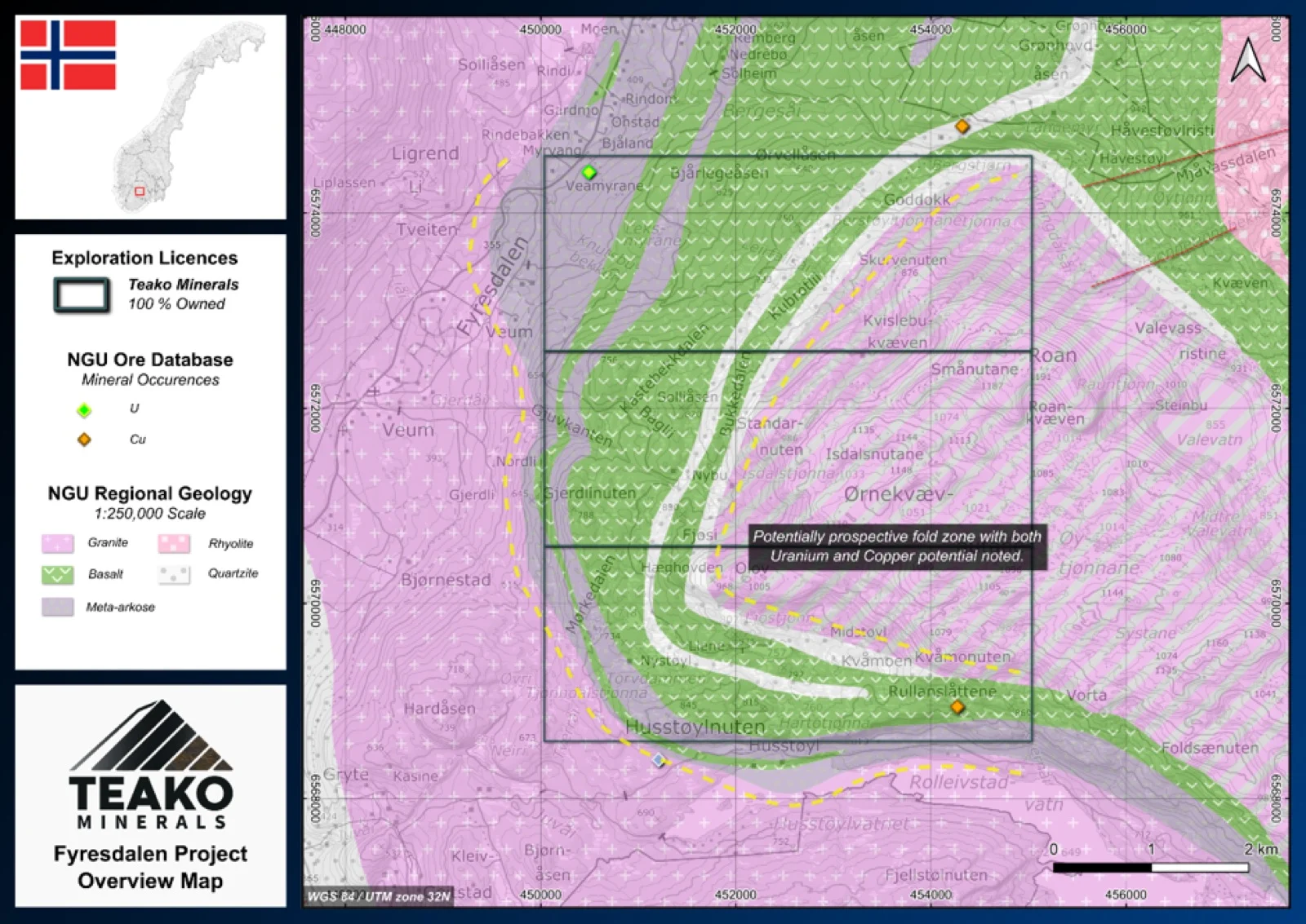
Teako’s 100% owned Fyresdalen Project covers 30 km2 and is located in the southern part of the Telemark project cluster, with convenient road access to the project area. To date, two mineral occurrences (classified as energy metals (U/Th) and base metals, respectively in the NGU ore database)1 have been identified within the project area; however, no descriptions are currently available. The limited existing data creates an opportunity for initial field investigations. The regional geology comprises a magmatic and metamorphic sequence belonging to the Bandak Group. The Mesoproterozoic geological package includes a belt of folded meta basalts in the central part of the project area, enveloped by granitic to granodioritic gneisses and associated with quartzitic metasediments. Initial exploration programmes should focus on verifying and characterizing the two known mineral occurrences. Once their presence has been confirmed, the project can progress to a systematic geological mapping campaign. The mapping programme should focus particularly on the fold zone that extends across much of the licence area. The folded basaltic unit may represent a prospective exploration target, as similar rocks are known to host several base-metal occurrences approximately 20 km to the northeast.
{{fig:1}}
1Teako has not performed sufficient work to verify the published data reported above, but the Company believes this information to be considered reliable and relevant. Results reported are maximum values and may not be representative of all samples collected within the area being evaluated
References
References to the ‘NGU’ regard the ‘Norwegian Geological Survey’, in particular, their Resource Database and are consolidated under this citation for simplicity. For all data sourced from this resource, please refer to: https://geo.ngu.no/kart/mineralressurser_mobil/?lang=eng
Exploration-stage project. Any historical production, grades or estimates quoted in project descriptions are historical in nature, have not been verified by the Company as current mineral resources or reserves, and should not be relied upon. See the cautionary statements and the Qualified Person statement.