
Overview
Merkedammen
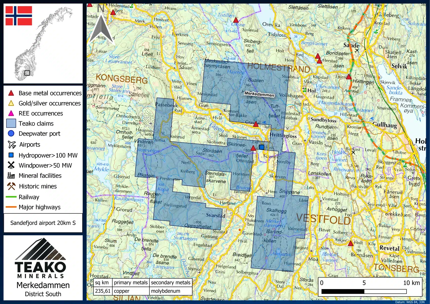
Location
Southern Norway
Size
235 sq. km
Primary Metals
Copper
Secondary Metals
Molybdenum
Description
Merkedammen is part of the Project Hub. The Merkedammen project area consists of 26 contiguous license blocks in the Vestfold area in the south of Norway. The total license area measures 235 sq. km. in size and is located south of the cities of Drammen and Kongsberg near Oslo. On June 25, it was announced that a field crew has been mobilized to include Merkedammen in the Companys summer exploration program.
The claim hosts a highly developed and well-functional infrastructure such as roads, railways, deep-sea ports, hydropower stations, and airports nearby. Several roads provide access to the license area and minor forest tracks are usually in good condition. Forests and farmland characterize the hilly but not mountainous landscape. The milder climate of southern Norway enables a relatively large time window for exploration.
The project area is part of the Oslo Rift, which is comprised of a series of magmatic rocks belonging to the Fennoscandian Shield and are roughly 300 – 250 Ma. The oldest rocks in the Oslo Rift are of basaltic composition followed by the emplacement of large trachyte flows. These units were intruded by larvikite, which is quarried in the area. The Merkedammen project specifically is characterized by two major units: Larvikite to the west and latite to the east.
The Merkedammen project area has a history of exploration for molybdenum porphyry-style deposits, the majority of which was completed by LKAB in the 1980s. The area was explored for REEs during the 1960s and 1970s by the NGU, with radiometric and geochemical surveys being completed.
Later in the 1980s LKAB worked extensively in the project area completing a series of field programs, including soil sampling, prospecting and high-resolution IP. This led to numerous zones of anomalous molybdenum, tungsten and copper soil anomalies being identified in the area. Prospecting also led to the identification of areas hosting strong hydrothermal alteration and stockwork hydrothermal veins.
